
Geographic Information Systems (GIS)
Examples of relatively easy analysis using open source GIS software and data publically available at no cost. Further examples will be added here in the future.
Alluvial Deltas in the Marsh at Jug Bay
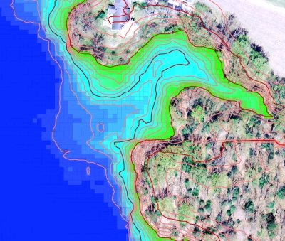
High resolution digital elevation data analyzed to show presence of deltas caused by sediments from small stream valleys. In the field, the small changes in elevation from the steam deposits are noticeable only from changes in vegetation. The GIS analysis confirmed the presence of the deltaic deposits and explains the vegetation change due to the subtle differences in habitat.
Since the objective was to examine deltas in a wider area, the aerial image was displayed for elevations above 10 m to provide better location context.
Low resolution image (for web) showing elevations from 0 to 10 m (dark blue to light green). The delta is seen as higher elevations (lighter blues) in marsh below the stream valley. 1 meter contours are also shown.